Skip to content
  • Menu
  • Search

Recent Posts

  • The Neighborhood Map of U.S. Obesity and Food Deserts Available as Data
  • USDA Food Desert data with Census tracts
  • 20 Years of Texas Concealed Handgun License Data Available
  • Online desktop applications
  • Public Land Ownership by State

Recent Comments

    Archives

    • November 2015
    • October 2015
    • July 2015
    • April 2015
    • February 2015
    • January 2015

    Categories

    • links
    • Uncategorized

    Meta

    • Log in
    • Entries feed
    • Comments feed
    • WordPress.org

    The Data Janitor

    data! data! data!

    Month: February 2015

    Published on February 18, 2015 by thedatajanitor

    Public Land Ownership by State

    I liked this map a lot and how it resizes the state to the proportion owned by the federal government.

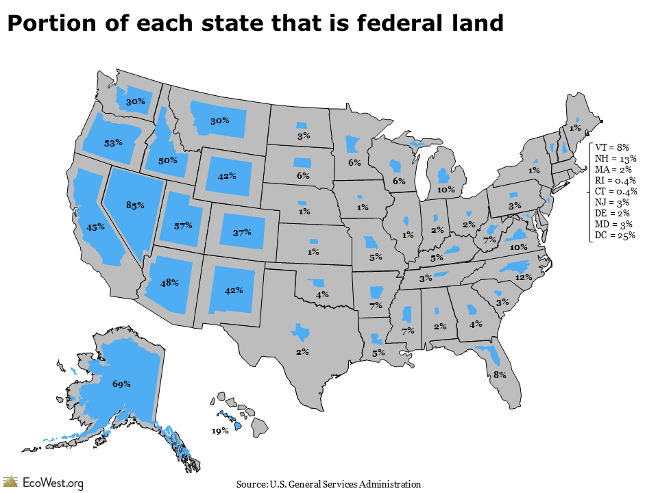
    I found the raw data in a pdf so I converted it to a Google Docs spreadsheet to make it easier to use. Get the data.

    0 Thought Uncategorized

    The Data Janitor

    data! data! data!

    Theme: Nulis by Supakunza
    Proudly powered by WordPress